Maharashtra BhuNaksha Online – View Village Maps and Plot Boundaries From Your Phone
Checking the location and recorded shape of a land parcel is an important part of understanding property records. In Maharashtra, citizens can access digital cadastral maps through Maharashtra BhuNaksha, also known as Mahabhunakasha. The service makes it possible to view available village maps and locate individual plots using a phone or computer.
While records such as 7/12 Utara and 8A Extract provide textual information about land, BhuNaksha provides a visual representation of parcels on a cadastral map. This can help users understand where a particular Survey, Gat or Plot Number is located in relation to nearby parcels.
However, an online map should be used carefully. A digital cadastral boundary is useful for land-record reference, but it should not automatically be treated as a final physical demarcation on the ground.
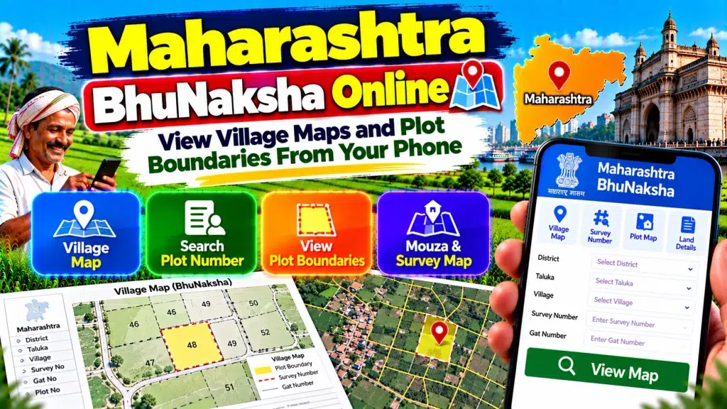
This guide explains Maharashtra BhuNaksha Online, how to view village maps and plot boundaries from your phone, and how to compare maps with other Maharashtra land records.
Maharashtra BhuNaksha Online – Quick Overview
| Details | Information |
|---|---|
| State | Maharashtra |
| Map Service | BhuNaksha / Mahabhunakasha |
| Service Type | Cadastral Land Map |
| Main Purpose | View village maps and land parcels |
| Search Reference | Plot Number |
| Common Parcel Reference | Survey Number / Gat Number |
| Location Details | District, Taluka and Village |
| Plot Information | Available for applicable parcels |
| Plot Report | Available |
| Related Land Record | 7/12 Utara |
| Related Account Record | 8A Extract |
| Digital Map Service | MH DIGI Maps |
| Land Measurement | e-Mojni |
| Mobile Access | Available |
| Authority | Maharashtra Land Records Department |
What Is Maharashtra BhuNaksha?
Maharashtra BhuNaksha is a digital cadastral mapping facility connected with Maharashtra’s land-record services.
The state’s integrated Mahabhumi system refers to the service as Mahabhunakasha – Maps with Land Records.
A cadastral map represents individual land parcels within a particular revenue area. Instead of reading only names, numbers and areas from a textual record, users can visually examine how parcels are arranged.
This makes BhuNaksha useful for landowners, buyers, farmers and family members who want to understand the location of a property in the available village map.
What Can You Check on BhuNaksha?
BhuNaksha can provide useful spatial information about available land parcels.
After selecting the correct location and parcel, users can examine the plot on the village map.
The system provides Plot Information for applicable parcels and also supports plot-report functionality.
A cadastral map can help you understand the relative shape and location of a plot and its relationship with surrounding parcels.
It should be compared with the applicable textual records before making conclusions about a property.
What Is a Village Map?
A Village Map is a cadastral representation of land parcels within a village or applicable revenue area.
Individual parcels are represented through boundaries and parcel references.
The map helps users understand how one plot is positioned in relation to another.
For example, if your 7/12 contains a Survey or Gat Number, the applicable map can provide visual context for that parcel.
Village maps are particularly useful when several adjoining plots are involved in a property transaction or family partition.
Survey Number and Gat Number Explained
A Survey Number is an important reference used to identify surveyed land.
A Gat Number is another parcel reference commonly encountered in Maharashtra land records.
These references can appear in 7/12 Utara, registered property documents and other land records.
When using BhuNaksha, never rely only on a numerical parcel reference.
Always confirm the correct District, Taluka and Village, because similar parcel numbers can exist in different locations.
How to View Maharashtra BhuNaksha Online
Start by opening the official Maharashtra BhuNaksha service.
Select the appropriate location or category.
Choose your District.
Select the correct Taluka.
Choose the Village where the property is situated.
Use the available Plot Number search facility.
Enter the relevant parcel number and locate the plot.
Select the intended parcel on the map.
Review the available Plot Information and cadastral layout.
Compare the result with your 7/12, deed or other reliable property document.
The interface may be updated over time, so follow the options currently displayed by the official service.
How to Check BhuNaksha From Your Phone
Maharashtra provides a mobile-oriented BhuNaksha interface, making it possible to access village maps from a smartphone.
Keep your existing land documents nearby.
Confirm the District, Taluka, Village and parcel reference before starting.
Search for the applicable plot and zoom into the map carefully.
Because cadastral maps can contain several small parcels, using landscape orientation can make the map easier to examine.
For important verification, compare what you see on the phone with the latest official land records.
How to Search Plot Number on BhuNaksha
The current mobile BhuNaksha interface provides a Search Online: Plot No option.
Enter the relevant Plot Number after identifying the correct village.
Select the parcel shown in the result.
The system can display available Plot Information.
If the number does not return the expected parcel, check the Village and other location details again.
Do not select another parcel simply because its number or shape appears similar.
What Is Plot Information?
Plot Information provides details associated with the selected parcel in the mapping system.
It helps connect the graphical parcel on the map with its land-record reference.
This can be useful when checking whether you have located the intended plot.
However, map information should be compared with the latest 7/12 and applicable property documents.
A map-based result alone should not be used as the only basis for determining legal ownership.
What Is a BhuNaksha Plot Report?
The official Maharashtra BhuNaksha system currently provides a Plot Report facility.
For an applicable parcel, the report interface can display location details such as the category, District, Taluka, Village and Plot Number.
The system provides options including Single Plot and All Plots of Same Owner.
A PDF report option is also available in the current interface.
Availability and report contents can vary according to the selected land record.
BhuNaksha and 7/12 Utara
The 7/12 Utara and BhuNaksha serve different purposes.
7/12 is primarily a textual revenue record associated with agricultural land and the recorded holding.
BhuNaksha provides spatial or map-based information.
For better verification, compare the Survey/Gat or Plot reference in the 7/12 with the parcel displayed on the cadastral map.
Also compare the recorded land area and other relevant information.
Using both records together can provide a clearer understanding of the property.
BhuNaksha and 8A Extract
The 8A Extract provides related holding or land-account information.
It should not be confused with a cadastral map.
While 8A helps users understand the applicable Khata or account context, BhuNaksha shows the spatial arrangement of parcels.
Depending on the purpose of your search, you may therefore need to review the 7/12, 8A and BhuNaksha together.
Each record provides a different part of the overall land information.
Can BhuNaksha Show Plot Boundaries?
A cadastral map displays the recorded outline of available land parcels.
This can help users understand the relative boundaries and shape of a plot.
You may also be able to see how the selected parcel relates to neighbouring plots.
However, the boundary displayed on a digital map should not automatically be interpreted as a precise boundary physically marked on the ground.
This distinction becomes particularly important when neighbouring landholders disagree about the actual boundary.
BhuNaksha vs Physical Land Measurement
BhuNaksha provides a digital cadastral map, while land measurement or Mojni deals with measurement and boundary-related work on the ground.
Maharashtra provides an official e-Mojni system for land-measurement cases.
The land-record department states that measurement is carried out using original records to address applicable land-related questions or disputes.
Therefore, if you simply want to understand a plot’s recorded location, BhuNaksha can be useful.
If an exact physical boundary needs to be established, the appropriate official measurement process may be required.
What If the Online Boundary Looks Different?
First verify that you selected the correct Village and parcel.
Compare the map with the latest 7/12.
Check whether the land has undergone subdivision or another survey or record change.
Review mutation information if the property has recently been transferred or partitioned.
Older documents can sometimes contain references that need to be compared with later survey and revenue records.
If a genuine boundary discrepancy remains, use the appropriate official land-record or measurement procedure rather than relying only on a screenshot.
Maharashtra BhuNaksha Before Buying Land
Checking the cadastral map can be useful during preliminary property verification.
Start by identifying the Survey/Gat Number from the seller’s documents.
Check the current 7/12.
Locate the applicable parcel on BhuNaksha.
Review the surrounding plots and recorded shape.
Compare the land area with the revenue records.
Review 8A and mutation information where relevant.
If exact boundaries are important, an official land measurement may also be appropriate.
The registered deed and other legally relevant property documents should be examined separately.
Can You Download Digital Land Maps?
Maharashtra’s integrated Mahabhumi portal currently lists MH DIGI Maps among its digitally signed premium services.
BhuNaksha also provides report-related facilities for applicable plots.
The type of map or report you need depends on its intended use.
A simple online map may be enough for preliminary viewing, while an authenticated or digitally signed map may be required for certain formal purposes.
Always use the applicable official service rather than an unofficial downloaded image.
Does BhuNaksha Prove Land Ownership?
BhuNaksha is an important source of spatial land-record information, but a cadastral map alone should not be treated as conclusive proof of legal ownership.
Ownership verification can involve the registered deed, current 7/12, 8A, mutation history, inheritance records, gift or partition documents, court orders and other legally relevant records.
The map is best used as one component of a broader land-verification process.
Frequently Asked Questions (FAQ)
1. What is Maharashtra BhuNaksha?
Maharashtra BhuNaksha or Mahabhunakasha is an online cadastral map service connected with state land records.
2. Can I view Maharashtra village maps online?
Yes. Available village maps can be accessed through the official BhuNaksha service.
3. Can I check BhuNaksha from my mobile?
Yes. Maharashtra currently provides a mobile-oriented BhuNaksha interface.
4. How can I find my plot?
Select the correct location and use the available Plot Number search facility.
5. What is a Survey or Gat Number?
It is an important parcel reference used in Maharashtra land and survey records.
6. Can I see plot boundaries online?
The cadastral map can display the recorded outline and relative boundaries of available parcels.
7. Is BhuNaksha the same as 7/12 Utara?
No. BhuNaksha provides map information, while 7/12 is primarily a textual land record.
8. Can I generate a Plot Report?
Yes. The current BhuNaksha system provides report functionality for applicable parcels.
9. What should I do if the boundary is disputed?
An official land-measurement or demarcation process may be required rather than relying solely on the online map.
10. Is BhuNaksha proof of ownership?
No. It should be considered together with registered deeds and other applicable revenue and legal records.
Conclusion
Maharashtra BhuNaksha Online makes it easier to view village maps and plot boundaries from your phone. Through Mahabhunakasha, users can locate available parcels, review Plot Information and understand the spatial relationship between neighbouring plots.
For an accurate search, always verify the correct District, Taluka, Village and Survey/Gat or Plot Number. Compare the cadastral map with the latest 7/12 Utara, 8A and relevant property documents.
Most importantly, remember that an online map shows the cadastral record; it does not automatically establish the exact physical boundary on the ground. Where a boundary is disputed or precise demarcation is required, Maharashtra’s official land-measurement process should be used.
By combining BhuNaksha with current revenue records, mutation information and legally relevant property documents, users can build a clearer picture of their Maharashtra land records.