Madhya Pradesh BhuNaksha Online – View Village Maps and Plot Boundaries From Your Mobile
Digital land-record services have made it easier for landowners, farmers and property buyers to understand land information without relying only on paper records. Along with textual records such as Khasra and B-1 Khatauni, a cadastral land map can provide useful visual information about surveyed plots.
In Madhya Pradesh, land maps can help users understand the recorded layout of parcels within a village. By identifying the correct Khasra or Survey Number, users can relate a textual land record to its location and shape on the applicable cadastral map.
This is especially useful when a landholding contains several plots or when you want to understand the relative position of a particular parcel.
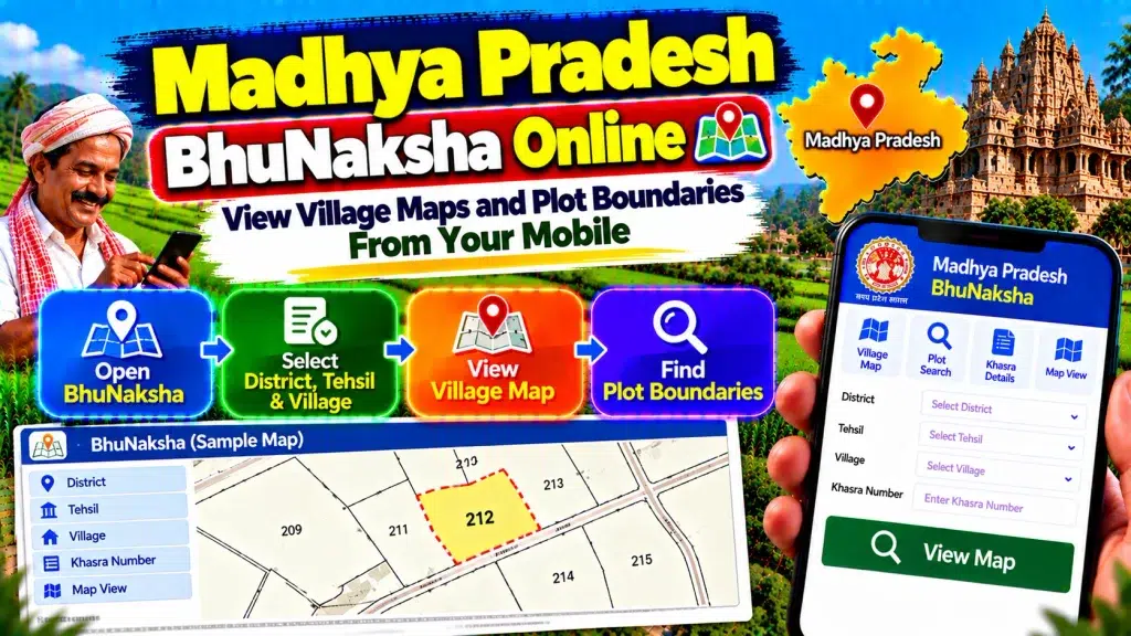
This guide explains Madhya Pradesh BhuNaksha Online, how to view village maps and plot boundaries from your mobile, how Khasra Numbers relate to maps, and when an official physical demarcation may still be necessary.
Madhya Pradesh BhuNaksha Online – Quick Overview
| Details | Information |
|---|---|
| State | Madhya Pradesh |
| Record Type | Cadastral / Land Map |
| Common Search Term | MP BhuNaksha |
| Main Parcel Reference | Khasra / Survey Number |
| Location Details | District, Tehsil and Village |
| Map Purpose | View surveyed parcel layout |
| Plot Shape | Can be viewed in applicable map |
| Recorded Boundaries | Shown in cadastral context |
| Related Parcel Record | Khasra |
| Related Holding Record | B-1 Khatauni |
| Certified Map Copy | Available through applicable services |
| Physical Boundary Check | Official demarcation may be required |
| Device | Mobile, Tablet or Computer |
| Main Use | Understanding plot location and boundaries |
What Is Madhya Pradesh BhuNaksha?
BhuNaksha is commonly used to describe a digital cadastral or land map.
A cadastral map represents surveyed land parcels within an administrative or revenue area. Individual plots are shown in relation to surrounding parcels.
In Madhya Pradesh, land maps work as an important companion to textual revenue records.
A Khasra record can provide information about a specific parcel, while the cadastral map helps you understand where that parcel appears within the mapped village layout.
The two should therefore be compared rather than treated as substitutes for each other.
What Is a Village Land Map?
A village land map is a survey-based map showing the layout of land parcels within the applicable village.
Individual parcels can be represented through their survey boundaries and references.
This type of map is useful when you want to understand how one Khasra parcel relates to nearby plots.
However, a village cadastral map should not be confused with an ordinary road or satellite map.
Its main purpose is land administration and survey-related parcel representation.
What Is a Khasra Number?
A Khasra Number is an important parcel reference used in Madhya Pradesh land records.
It identifies a surveyed piece of land within the applicable revenue village.
When checking a cadastral map, the Khasra Number helps connect the map parcel with the corresponding textual revenue information.
Always verify the District, Tehsil and Village along with the Khasra Number.
A numerical parcel reference alone is not sufficient to identify land across the entire state.
What Details Can You View on a BhuNaksha?
The exact information can vary depending on the available digital map and current government service.
A cadastral map can generally help users understand the layout of surveyed parcels, the relative shape of a plot and its relationship with neighbouring plots.
Khasra or Survey references may help identify individual parcels.
The map is particularly useful for visual context.
For recorded landholder information, land area and broader holding details, users should also review the applicable Khasra and B-1 records.
How to Check Madhya Pradesh BhuNaksha Online
Start with the applicable official Madhya Pradesh land-record or map service.
Choose the relevant land-map option available on the current system.
Select the correct District.
Choose the Tehsil.
Select the Village where the land is situated.
Locate or enter the relevant Khasra/Survey Number where the service provides this option.
Open the available map information.
Review the selected parcel and neighbouring plots.
Because government interfaces can change, always follow the current fields and instructions displayed by the official service.
How to View MP Village Maps From Your Mobile
A smartphone can be used for an initial cadastral-map check.
Before beginning, keep your Khasra, B-1 or registered property document nearby.
Note the correct District, Tehsil, Village and Khasra Number.
Open the applicable official service using your mobile browser.
Select the required location and parcel.
Once the map appears, use the zoom controls carefully to inspect the plot and nearby parcels.
For easier viewing of a complex village map, rotating your phone to landscape mode may also help.
How to Find Your Plot on the Map
The safest starting point is the Khasra/Survey Number shown in your existing land documents.
Use the correct Village and locate the corresponding parcel reference on the cadastral map.
After finding the parcel, compare its reference with the applicable Khasra record.
Do not identify land only from its visual shape.
Several plots can appear similar on a map, and a parcel’s shape can be difficult to interpret on a small screen.
The parcel reference and location details should match your records.
Can MP BhuNaksha Show Plot Boundaries?
A cadastral map can show the recorded survey outline or boundary context of land parcels.
This can help users understand the shape of a Khasra and how it is positioned next to neighbouring plots.
However, the lines displayed on a digital cadastral map should not automatically be interpreted as exact physical boundary markers visible on the ground.
The map provides survey-record context.
Where the exact physical boundary is disputed or unclear, an official demarcation process may be necessary.
BhuNaksha vs Khasra Record
BhuNaksha and Khasra provide different types of information.
The Khasra record is mainly textual and parcel-oriented. It can provide important revenue information connected with the individual land parcel.
The BhuNaksha or cadastral map provides spatial context.
For example, a Khasra can help you identify the parcel and its recorded details, while the map can help you understand the parcel’s shape and relative location.
Using both records together provides a clearer picture.
BhuNaksha vs B-1 Khatauni
B-1 Khatauni provides broader landholding or account-related information.
It is different from a cadastral map.
A single B-1 holding may be associated with several Khasra parcels.
Each parcel can then appear separately on the applicable land map.
Therefore, when checking a larger agricultural holding, identify the relevant Khasra Numbers from the land records and locate each required parcel on the map.
This is especially important if only some parcels are involved in a transaction.
How to Check Land Area
A map can help you understand the shape of a parcel, but you should not calculate official land area simply by looking at the map.
Use the relevant textual Khasra record to check the recorded parcel area.
Compare it with the B-1 and registered property documents.
If several Khasra Numbers are involved, verify each parcel separately.
The cadastral map should primarily be used for spatial context rather than as the sole source for determining official recorded area.
Certified Land Map Copy
Madhya Pradesh’s citizen services include facilities related to certified copies of current land maps.
This is important when a land map is required for an official or administrative purpose.
A screenshot taken from a mobile phone should not automatically be treated as equivalent to a certified map copy.
If you need the map for a formal application, property matter or another official purpose, check which authenticated or certified document is required by the relevant authority.
What Is Land Demarcation?
Land demarcation is the process of identifying the applicable parcel boundary on the ground using relevant survey and revenue records.
It becomes particularly important when neighbouring landowners disagree about the location of a boundary.
Madhya Pradesh provides an official demarcation-related revenue service.
A cadastral map can be useful before applying for demarcation because it provides the recorded parcel layout.
However, the online map itself does not replace the applicable official on-ground procedure.
When Is Official Demarcation Needed?
Official demarcation may be relevant when physical boundary markers are missing, neighbouring owners disagree about a boundary, or the location of a parcel cannot be reliably identified on the ground.
It can also become important before certain construction or fencing decisions where the actual boundary needs to be clearly established.
Do not attempt to settle a serious land dispute solely by comparing screenshots.
Use the appropriate official survey or demarcation procedure where necessary.
BhuNaksha and Mutation
Mutation or Namantaran updates applicable revenue records following a qualifying change such as sale, inheritance, gift or partition.
Where a transaction or partition affects parcel references, check the latest Khasra and related map information after the applicable process is completed.
A mutation entry and cadastral map serve different purposes.
Mutation deals with updating revenue information, while the map represents surveyed parcel layout.
For complete verification, review both where relevant.
What If the Plot Cannot Be Found?
First check the District, Tehsil and Village.
Confirm the Khasra Number from a reliable land document.
If you are using an older document, check whether the parcel reference has changed because of partition, subdivision or another survey-related update.
Compare the latest Khasra and B-1 records.
If you still cannot identify the parcel, contact the appropriate Revenue or Survey authority through official channels rather than guessing from neighbouring plots.
BhuNaksha Before Buying Land
A cadastral map can be useful during preliminary property verification.
Identify every Khasra Number included in the proposed transaction.
Check the corresponding Khasra records.
Compare the B-1 Khatauni.
Locate the relevant parcels on the cadastral map.
Review their relative position and neighbouring plots.
Also examine the registered deed and applicable mutation information.
If the physical boundary is important or disputed, consider the appropriate official demarcation process before making a major property decision.
Does BhuNaksha Prove Ownership?
A BhuNaksha or cadastral map is a survey-related land record and should not automatically be treated as standalone conclusive proof of legal ownership.
Ownership verification may require registered deeds, inheritance or succession documents, gift or partition deeds, mutation history, court orders and other applicable records.
Use the cadastral map to understand the surveyed parcel, while using the relevant legal and revenue documents for broader property verification.
Frequently Asked Questions (FAQ)
1. What is Madhya Pradesh BhuNaksha?
MP BhuNaksha commonly refers to cadastral or digital land-map information showing surveyed parcels within a village.
2. Can I view MP village maps online?
Applicable Madhya Pradesh digital land services provide access to land-map information and related map services.
3. Can I check BhuNaksha from my mobile?
Yes. Applicable online map services can be accessed using a suitable smartphone and browser.
4. What details are needed to find a plot?
Keep the District, Tehsil, Village and Khasra/Survey Number available.
5. Does BhuNaksha show plot boundaries?
It can show the recorded cadastral outline and relative boundary context of surveyed parcels.
6. Is BhuNaksha the same as Khasra?
No. Khasra is primarily a textual parcel record, while BhuNaksha provides spatial or map information.
7. Is BhuNaksha the same as B-1 Khatauni?
No. B-1 provides broader landholding information, whereas BhuNaksha represents surveyed parcels on a map.
8. Can I get a certified land-map copy?
Madhya Pradesh’s official citizen services include certified copies of current land maps.
9. Can an online map settle a boundary dispute?
Not by itself. An official demarcation or survey may be necessary where the physical boundary is disputed.
10. Does BhuNaksha prove land ownership?
No. It should be compared with Khasra, B-1, registered deeds and other applicable legal and revenue records.
Conclusion
Madhya Pradesh BhuNaksha Online makes it easier to view village maps and plot boundaries from your mobile and understand the spatial context of a land parcel.
Start with the correct District, Tehsil, Village and Khasra/Survey Number. Locate the parcel on the applicable cadastral map and compare it with the latest Khasra and B-1 Khatauni records.
Remember that a digital map is primarily useful for understanding the recorded parcel layout. It should not automatically be treated as an exact physical demarcation or standalone proof of ownership.
If the actual boundary is disputed, use the appropriate official land-demarcation process. For formal purposes, obtain the applicable certified map or land-record copy instead of depending only on a mobile screenshot.
By checking the cadastral map together with Khasra, B-1, mutation information and registered property documents, you can obtain a clearer understanding of land and plot records in Madhya Pradesh.