Land & Property Records Online India – Check Ownership, Survey Number, Plot Details, RoR, Mutation & Property Records State-Wise
Land and property records are important documents for anyone who owns, buys, sells, inherits or plans to finance property in India. Before purchasing agricultural land, a residential plot, house or other immovable property, it is useful to check the available land records and compare them with the documents provided by the property owner or seller.
India does not have one identical land-record system for every state. Different states use different names for their revenue and land documents. Depending on the location, you may come across terms such as RoR, Khasra, Khatauni, Khatian, Jamabandi, Patta, Chitta, Adangal, RTC, Pahani, 7/12 Utara, 8A and Property Card.
Many States and Union Territories have digitized substantial parts of their land-record systems. Depending on the location and service available, citizens may be able to check recorded landholder details, survey or plot numbers, land area, mutation information, cadastral maps and related records online.
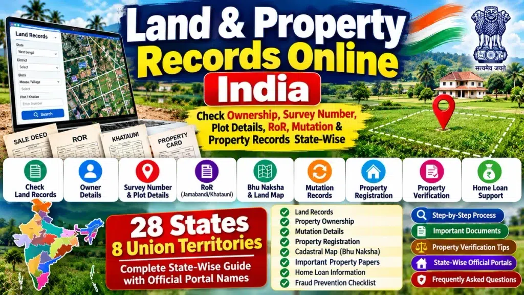
This complete guide explains Land & Property Records Online in India, the different property papers commonly used across states, how to search land using a survey or plot number, and what documents should be checked before an important property transaction.
Land & Property Records India – Quick Overview
| Particular | Details |
|---|---|
| Service | Land & Property Records |
| Coverage | All States and Union Territories of India |
| Main Record | Record of Rights (RoR) |
| Common Search | Survey No., Plot No., Khasra, Khata, Khatian |
| Information | Recorded Landholder, Area, Parcel & Land Details |
| Mutation | State-specific online/offline services |
| Land Map | Cadastral Map/Bhu Naksha where available |
| Registration | State Registration Department/SRO |
| Property Papers | RoR, Deed, Mutation, Tax and other applicable records |
| Purpose | Land Information & Preliminary Property Verification |
What Are Land and Property Records?
Land records are government-maintained records associated with land parcels, landholdings, revenue administration and rights or interests recorded against land.
A typical land record may contain information relating to:
- Recorded landholder or owner
- Survey number
- Plot number
- Khasra or Gata number
- Khata, Khatauni or Khatian
- Land area
- Land classification
- Revenue information
- Mutation entries
- Record of Rights
- Cadastral map or parcel information
Property records can be a broader concept. Apart from revenue land records, property verification may involve registered deeds, registration information, property-tax records, approved plans, encumbrance-related information where applicable and other documents.
Therefore, land record and property record should not automatically be considered the same thing.
What Is Record of Rights – RoR?
The Record of Rights (RoR) is an important component of land administration.
Depending on the state, an RoR may contain information concerning people having recorded rights in the land, the nature and extent of those rights, parcel details and applicable revenue information.
Different states use different terminology. Users may encounter records known as:
Jamabandi – Khatauni – Khatian – RTC – Pahani – 7/12 – Patta – Adangal
The format, information and legal significance of these records vary according to the applicable state system.
What Land and Property Details Can Be Checked?
Recorded Owner or Landholder Details
Land records may show the name of the person or persons recorded against a particular parcel. This can be useful for preliminary verification of property information.
Survey Number
A survey number is commonly used to identify a particular parcel of surveyed land.
Plot Number
Plot numbers may identify individual parcels. Depending on the state, equivalent identifiers may include Khasra, Gata, Dag or other numbers.
Khata, Khatauni and Khatian
These terms are used by different states for records associated with landholdings, landholders and parcels.
Land Area and Classification
Records may contain the area and classification or nature of the land.
Mutation Information
Mutation generally involves updating the relevant revenue record following a recognized change affecting the recorded landholder.
Cadastral Map / Bhu Naksha
Where digital mapping is available, users may be able to view parcel boundaries and other spatial information through cadastral-map systems.
State-Wise Land & Property Records in India
Land-record systems and terminology vary significantly between states. The following table covers all 28 States and provides commonly searched land records together with the corresponding official RoR/land-record portal or government system.
| State | Common Land Records / Details | Official Land Record Website / Portal |
|---|---|---|
| Andhra Pradesh | Adangal, RoR-1B, Survey Number, Pattadar Details | Mee Bhoomi / CCLA Andhra Pradesh |
| Arunachal Pradesh | Land & Revenue Records | Online RoR Portal Not Listed in DILRMP Directory |
| Assam | Jamabandi, Patta, Dag Number, Land Details | Dharitree |
| Bihar | Jamabandi, Khata, Khesra, Plot Details | Bihar Bhoomi |
| Chhattisgarh | B1, P-II, Khasra, Land Records | Bhuiyan Chhattisgarh |
| Goa | Form I & XIV, Survey Number, Land Details | Directorate of Settlement & Land Records (DSLR) |
| Gujarat | 7/12, 8A, Survey and Rural Land Records | e-Dhara / AnyRoR System |
| Haryana | Jamabandi, Khewat, Khatauni, Khasra | Jamabandi Haryana |
| Himachal Pradesh | Jamabandi, Khata, Khasra | Himbhoomi |
| Jharkhand | Register-II, Khata, Plot Details | Jharbhoomi |
| Karnataka | RTC, Pahani, Survey Number, Mutation | Bhoomi Karnataka |
| Kerala | RoR, Survey, Thandaper, Land Details | Revenue Land Information System / ReLIS |
| Madhya Pradesh | Khasra, B-1, Land Records and Maps | MP Bhulekh |
| Maharashtra | 7/12 Utara, 8A, Property Card, Survey/Gat | Mahabhumi / Mahabhulekh |
| Manipur | Patta, Dag and Land Details | Loucha Pathap |
| Meghalaya | Land & Revenue Records | Online RoR Portal Not Listed in DILRMP Directory |
| Mizoram | Land & Revenue Records | Online RoR Portal Not Listed in DILRMP Directory |
| Nagaland | Land & Revenue Records | Online RoR Portal Not Listed in DILRMP Directory |
| Odisha | RoR, Khatiyan, Plot, Tenant Details | Bhulekh Odisha |
| Punjab | Jamabandi, Fard, Khewat, Khatauni, Khasra | Punjab Land Records / Jamabandi System |
| Rajasthan | Jamabandi, Khasra, Khata | Apna Khata Rajasthan |
| Sikkim | Land & Revenue Records | Online RoR Portal Not Listed in DILRMP Directory |
| Tamil Nadu | Patta, Chitta, Survey and Land Details | Tamil Nilam / Tamil Nadu Land Records System |
| Telangana | RoR, Survey Number, Land Details | Web Land Telangana |
| Tripura | RoR, Khatian, Plot Details | Jami Tripura / e-Jami |
| Uttar Pradesh | Khasra, Khatauni, Gata Number | UP Bhulekh |
| Uttarakhand | Khatauni, Khasra, Land Details | Bhulekh Uttarakhand |
| West Bengal | Khatian, Plot, Mouza, Land Details | Bhumi / West Bengal Land Records System |
The Government of India’s DILRMP directory separately identifies RoR, BhuNaksha, land-record and property-registration systems; consequently, one state can have several official systems rather than one website handling every service.
Union Territory Land & Property Records
India’s Union Territories should also be included if the page is intended to function as a complete All-India land-record guide.
| Union Territory | Common Land Record Information | Official Land Record Website / Portal |
|---|---|---|
| Andaman & Nicobar Islands | RoR and Land Details | Dweep Bhoomi |
| Chandigarh | Jamabandi and Land Details | Online Jamabandi Chandigarh |
| Dadra & Nagar Haveli and Daman & Diu | RoR and Land Records | Avanika |
| Delhi (NCT) | Land/Revenue Record Details | Delhi Land Records / Revenue Department System |
| Jammu & Kashmir | RoR and Land Records | Land Records Information System |
| Ladakh | Land & Revenue Records | Online RoR Portal Not Listed in DILRMP Directory |
| Lakshadweep | RoR and Land Records | Land Records Information System |
| Puducherry | Land and Revenue Records | Nilamagal |
Note: “Online RoR Portal Not Listed” does not necessarily mean that no government land-related service exists in that jurisdiction. It means an online RoR portal is not listed for it in the Government of India’s DILRMP State/UT RoR directory.
Important Property Papers to Check
Checking only one online land record may not provide a complete picture of a property. Depending on the transaction and location, several documents can become relevant.
1. Sale Deed
A registered sale deed is a key document associated with a property sale. It records the transaction and contains important information concerning the property and parties involved.
2. Record of Rights
The RoR provides land/revenue-related information according to the applicable state system.
3. Mutation Record
Following a qualifying transfer, mutation may be required to update the concerned revenue record.
4. Survey and Plot Records
Survey number, plot number, Khasra, Dag, Gata or another applicable parcel identifier can help establish which land parcel is being examined.
5. Encumbrance-Related Information
Depending on the state and property, registration or encumbrance-related information may be relevant when reviewing past registered transactions or interests affecting a property.
6. Property Tax Records
For applicable properties, municipal or local-body tax records can provide additional information.
7. Approved Building Plan
For constructed properties, applicable sanctioned plans and approvals may need to be checked.
8. Land-Use Documents
Where relevant, verify whether the property’s proposed use corresponds with the applicable land classification and permissions.
How to Check Land Records Online
Although each state uses a different portal, the general process is often similar.
Step 1: Select Your State
First identify the State or Union Territory where the land is physically located.
Step 2: Identify the Official Portal
Use the appropriate official Revenue Department, Land Records Department or authorized land-record system.
Step 3: Select Property Location
The portal may require:
District → Tehsil/Taluk/Circle → Village/Mouza
Step 4: Select Search Type
Available search fields may include:
Survey Number – Plot Number – Khasra – Gata – Dag – Khata – Khatauni – Khatian – Pattadar Details
Step 5: Enter the Required Information
Enter the details carefully because an incorrect parcel number can return a different record or no result.
Step 6: Check the Record
Compare the displayed information with your existing property documents.
Step 7: Obtain an Official Copy Where Available
Where a state provides downloadable or digitally signed RoR records, follow the concerned portal’s process.
The Department of Land Resources also states that RoR copies may be accessed through the applicable online systems or, depending on the jurisdiction, through revenue officials/CSC or kiosk facilities.
How to Check Property Owner Details
A commonly searched question is:
“How can I check land owner details using a survey number?”
Where the concerned state system provides this facility, start with the correct parcel identifier.
Compare:
Recorded Landholder → Survey/Plot Number → Land Area → Village/Mouza → Land Classification
If important information does not match the seller’s documents, further verification may be necessary before proceeding with a transaction.
A revenue-record entry should not automatically be treated as conclusive proof of clear property title.
How to Check Land by Survey Number
If you already know the survey number, the process may be comparatively simple:
Select State → District → Tehsil/Taluk → Village → Survey Number → Search
Some states divide survey numbers into subdivisions. If a parcel has been divided, resurveyed or renumbered, make sure you are checking the correct current parcel information.
Survey Number vs Plot Number vs Khasra vs Gata
The terminology depends on the state’s land administration system.
Survey Number: Generally identifies surveyed land.
Plot Number: Identifies a particular land parcel according to the applicable record system.
Khasra Number: Commonly used as a parcel identifier in several northern and central states.
Gata Number: A land-parcel identifier commonly encountered in Uttar Pradesh.
Dag Number: Commonly encountered in states such as Assam.
Because terminology is not uniform nationwide, users should follow the terminology used by the relevant official state portal.
What Is Property Mutation?
Property mutation generally refers to updating revenue records following a recognized change affecting the recorded landholder.
Mutation may become relevant after:
- Sale of property
- Inheritance
- Gift
- Partition
- Other recognized transfers
Registration and mutation are related to property transactions but are not the same process.
Land Record vs Property Registration
This distinction is important.
Land Record: Primarily relates to landholding, revenue, parcel and Record-of-Rights information under the concerned state’s land administration system.
Property Registration: Concerns registration of the relevant deed/document through the Registration Department or Sub-Registrar Office.
DILRMP itself treats computerization of land records and computerization of registration as connected but distinct components and promotes integration between Registration Offices and land-record systems.
Property Verification Before Buying Land
Before making a substantial payment for land or property, appropriate due diligence can be important.
| Verification | What to Check |
|---|---|
| Seller | Identity and authority to sell |
| Ownership/Title Papers | Names and property description |
| Sale/Title Deed | Registration and property particulars |
| Land Record | Recorded landholder and parcel details |
| Survey/Plot | Correct parcel identifier |
| Area | Record vs document/measurement |
| Mutation | Updated entry where applicable |
| Encumbrance | Applicable registration/claim information |
| Property Tax | Relevant records and dues |
| Land Use | Applicable classification/permission |
| Map | Parcel/location/boundary information |
| Approvals | Applicable building/layout approvals |
Requirements vary depending on whether the property is agricultural land, a residential plot, house, apartment or commercial property.
For a high-value transaction, appropriate legal verification by a qualified property professional or lawyer can be valuable.
Land Records and Home Loans
Property documentation can also be relevant when applying for a home loan, plot loan, construction loan or loan against property.
Banks and housing finance companies generally conduct their own legal and technical verification of the property.
Depending on the property and lender, documents may include ownership/title papers, registered deeds, applicable land records, tax-related records, approved plans and other supporting documentation.
Loan eligibility, documentation requirements, rates and approval conditions vary by lender.
Property Registration, Stamp Duty and Registration Charges
Property transactions can involve stamp duty and registration charges according to the rules of the relevant state.
Charges may depend on factors such as:
- State
- Property value
- Property type
- Location
- Applicable buyer category
- State-specific concessions
Buyers should always verify the current rates through the concerned State Registration Department because rates and rules can change.
Bhu Naksha and Cadastral Maps
A cadastral map represents individual land parcels and boundaries.
Several state systems provide digital cadastral-map services commonly referred to as Bhu Naksha.
Where available, users may select their district, tehsil and village and locate a parcel using the applicable parcel number.
DILRMP specifically includes digitization of cadastral maps and integration of textual RoR data with spatial/map records as part of India’s land-record modernization programme.
ULPIN / Bhu-Aadhaar
The Unique Land Parcel Identification Number (ULPIN) is another important part of India’s digital land-record modernization.
ULPIN is a 14-digit unique identification number assigned to a land parcel based on its geo-referenced coordinates. It is also commonly referred to as Bhu-Aadhaar.
ULPIN identifies a land parcel and should not be confused with an individual’s Aadhaar number.
Digital India Land Records Modernization Programme
The Digital India Land Records Modernization Programme (DILRMP) is a Government of India initiative intended to modernize land-record management and improve accessibility and transparency.
Its major areas include:
- Computerization of Records of Rights
- Digitization of cadastral maps
- Integration of textual and spatial land records
- Survey and resurvey
- Computerization of Sub-Registrar Offices
- Integration of registration and land records
- Modern record rooms
- Revenue-court computerization and integration
The Department of Land Resources describes improved real-time land information, reduced disputes, checks on fraudulent transactions and easier access to records as important objectives of the programme.
How to Avoid Property Fraud
Digital records can make preliminary property checking easier, but users should still exercise care.
Do not rely only on screenshots or copies provided by a seller. Compare the relevant details using applicable official sources.
Pay particular attention to differences in:
Owner/Landholder Name – Survey Number – Plot Number – Area – Property Description – Location – Registration Information
If the seller refuses to provide important documents or pressures you into making a large payment before adequate verification, additional caution is appropriate.
For substantial property transactions, consider appropriate legal and technical verification.
Frequently Asked Questions
Can I check land records online in India?
Many States and Union Territories provide online access to certain land records, although the available services differ by jurisdiction.
Is there one official Land Record India website for every state?
No. Land administration is primarily state/UT-specific, so different jurisdictions use their own systems. The Government of India’s DILRMP directory provides a State/UT-wise list of available RoR and related systems.
How can I check who owns a property?
Where the concerned state permits it, recorded landholder information may be searched using a survey, plot, Khasra, Khata or another parcel identifier. Additional documentation may be required for legal ownership/title verification.
Can I search land using a survey number?
Many state land-record systems support survey-number or equivalent parcel-number searches.
What is RoR?
RoR means Record of Rights. It is an important land/revenue record, although its exact format and contents differ between states.
What is Khasra?
Khasra is a land-parcel identifier commonly used in several state revenue systems.
What is Khatauni?
Khatauni is a land-record term used in certain states for records associated with holdings and landholders.
What is Khatian?
Khatian is a land-record/RoR-related term used in states including West Bengal and some other regions.
Can I download land records online?
Some state portals provide downloadable and/or digitally signed records. Availability and legal status vary by state.
Is an online land record proof of ownership?
An online revenue record should not automatically be treated as conclusive proof of clear title. Property-title verification can require additional registered and legal documents.
Is mutation the same as property registration?
No. Registration and mutation are separate processes.
What is a Property Card?
A Property Card is a property/land record used for certain surveyed or urban properties in some jurisdictions.
What is Bhu Naksha?
Bhu Naksha generally refers to a digital cadastral-map system showing land parcels.
What is Bhu-Aadhaar?
Bhu-Aadhaar commonly refers to ULPIN, the unique 14-digit identifier assigned to a geo-referenced land parcel.
Can land records be required for a home loan?
Property and land documents may form part of a lender’s property verification process. Exact requirements depend on the lender, property and loan product.
What documents should be checked before buying land?
Depending on the property and location, checks may include title/ownership documents, registered deeds, land records, survey details, mutation, applicable encumbrance information, property-tax records, maps and necessary approvals.
Conclusion
Land & Property Records Online India services provide an increasingly convenient way to access important information about land parcels and property-related records.
Depending on the State or Union Territory, users may be able to check recorded ownership/landholder details, Survey Number, Plot Number, RoR, Khasra, Khata, Khatauni, Khatian, Jamabandi, Patta, Chitta, RTC, Pahani, Adangal, 7/12 Utara, Property Card, mutation information and cadastral maps.
The most important point is that India’s land-record system is state-specific. There is no single terminology or identical portal that applies everywhere.
A practical approach is:
Select State → Identify Official Portal → Find Property → Check RoR → Match Survey/Plot Details → Review Mutation → Check Registration → Review Map/Other Records → Complete Property Verification
The Government of India’s DILRMP dashboard currently reports land-record computerization across more than 95% of villages covered by its dataset, while registration and land-record integration also continues to expand.
For anyone buying land, purchasing a house, verifying inherited property or arranging property-related finance, digital land records can be an important starting point. For major transactions, they should be combined with appropriate title, registration, legal and technical verification.
Disclaimer: This article is provided for general informational and educational purposes only. Land-record terminology, portal availability, procedures, registration requirements, charges and legal status of records vary between States and Union Territories and may change. Always verify current information through the concerned government authority. For property purchases, title disputes or significant transactions, consider advice from an appropriately qualified professional. This article does not constitute legal, investment, banking or financial advice.