Land Maps Online – How to View Village Maps and Plot Boundaries From Your Mobile
Digital land-record services have made it easier for landowners, farmers, property buyers and legal heirs to access important land information without starting every search at a revenue office. In many parts of India, citizens can now use a smartphone to view available village land maps, cadastral maps, plot locations and related land records online.
A digital land map can help you understand where a particular parcel is located and how it is positioned relative to surrounding plots. Depending on the state, a parcel may be identified through a Plot Number, Survey Number, Khasra Number, Gata Number or Dag Number.
However, land-map systems are maintained by State and Union Territory authorities, so the terminology and online process are not identical across India.
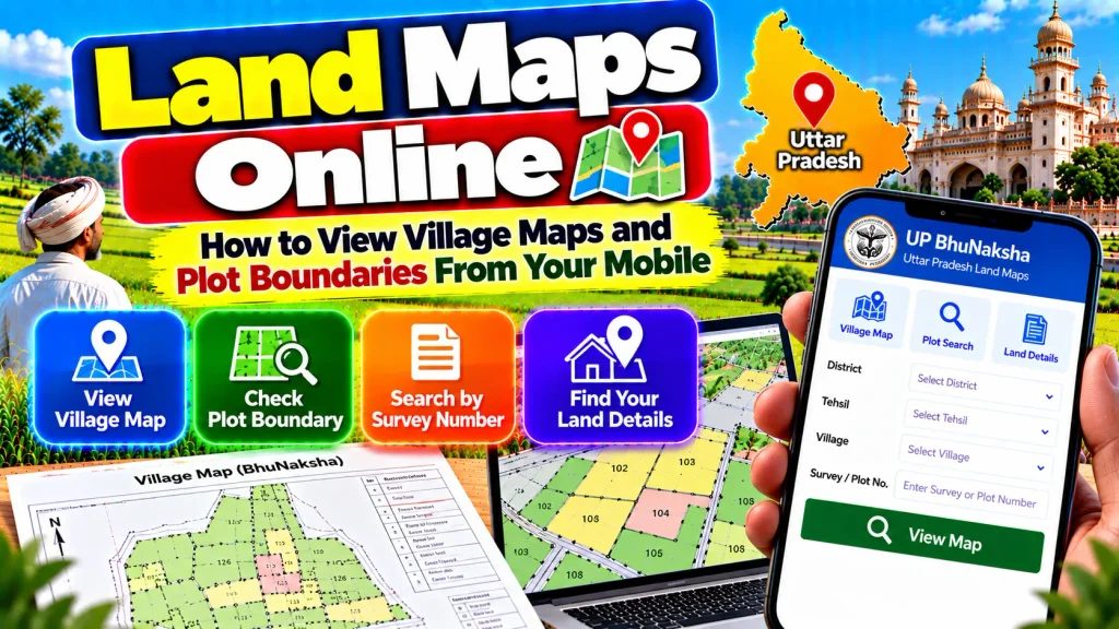
This guide explains Land Maps Online, how to view village maps and plot boundaries from your mobile, and how to compare map information with Record of Rights and other land documents.
Land Maps Online – Quick Overview
| Details | Information |
|---|---|
| Service | Digital Land / Cadastral Map |
| Device | Smartphone, Tablet or Computer |
| Main Purpose | View mapped land parcels |
| Location Search | State, District, Tehsil/Taluk, Village |
| Parcel Reference | Plot / Survey / Khasra / Gata / Dag Number |
| Village Map | Available for applicable digitized areas |
| Plot Boundary | Shown through mapped parcel lines |
| Land Area | Check applicable revenue records |
| Landholder Details | Check Record of Rights |
| RoR | Textual land-rights record |
| Cadastral Map | Spatial land record |
| Mutation | Revenue-record update after applicable changes |
| ULPIN | 14-digit unique parcel identifier |
| Physical Demarcation | Separate official process where required |
| Main Authority | State/UT Revenue or Survey Department |
What Is a Land Map?
A land map or cadastral map is a spatial record showing individual land parcels within a particular area.
Unlike an ordinary road map, a cadastral map focuses on property or land parcels.
The map can display the relative shape and position of different plots and the lines separating mapped parcels.
Digital cadastral maps are an important component of India’s land-record modernization efforts.
They are particularly useful when you already know the Plot, Survey, Khasra or other parcel number and want to understand where that parcel is situated.
What Is a Village Land Map?
A village land map shows the arrangement of land parcels within the relevant revenue village.
Individual plots can be represented with their applicable parcel references.
Depending on the state, users may encounter terms such as village map, BhuNaksha, Shajra, cadastral map, FMB or survey map.
These terms are not necessarily identical in every state’s administrative system.
The map should therefore be read according to the terminology and services provided by the concerned State Revenue or Survey Department.
Can You View Land Maps From a Mobile?
In many states, applicable digital land-map services can be accessed through a smartphone browser.
The Department of Land Resources describes cadastral maps and spatial land data as part of the citizen-centric digital land services being developed across India.
However, map availability depends on digitization and the services offered by the concerned state.
Some areas may provide detailed online maps, while others may have different levels of digital coverage.
Always start with the official state land-record or map service.
How to View Village Land Maps Online
First identify the State or Union Territory where the property is situated.
Open the official land-record, Revenue Department or cadastral-map portal.
Choose the available land-map, BhuNaksha, cadastral map or equivalent service.
Select the correct District.
Choose the Tehsil, Taluk, Mandal, Block or applicable local revenue unit.
Select the Village or Mouza.
Locate the relevant Plot, Survey, Khasra, Gata or Dag Number using the search options provided.
Open the parcel on the map and compare it with the corresponding revenue record.
The exact menu names vary by state and may change when government portals are updated.
What Is a Plot Number?
A Plot Number is a parcel reference used in various land-record systems.
It helps identify a particular piece of land within the relevant revenue or survey area.
A Plot Number should always be combined with location information.
The same numerical plot reference can potentially occur in different villages or revenue areas.
Therefore, when viewing a map, verify the State, District, local revenue unit and Village before selecting the plot.
What Is a Survey Number?
A Survey Number is another common reference used to identify surveyed land parcels.
Some states also use sub-division or Hissa references when an original survey parcel has been divided into smaller portions.
The Survey Number can help connect the mapped parcel with textual revenue records.
If a document includes a sub-division reference, check the complete reference rather than relying only on the original main Survey Number.
This helps prevent confusion between different portions of the same surveyed land.
Khasra, Gata and Dag Numbers
India does not use one identical parcel-number term nationwide.
In several northern land-record systems, users may encounter Khasra Number.
Uttar Pradesh digital land services frequently use Gata Number for parcels.
In some eastern and northeastern revenue systems, Dag Number may be used.
Other states primarily use Plot or Survey Numbers.
These references generally help identify parcels, but their exact administrative meaning should always be understood according to the concerned state’s land-record system.
How to Find Your Plot on a Village Map
Keep your property documents ready before opening the map.
Find the Plot, Survey, Khasra, Gata or Dag Number in the applicable registered deed or revenue record.
Select the correct location on the official map portal.
Search for or select the parcel number.
Once the plot is highlighted or displayed, examine the surrounding parcel references.
Compare the parcel with the corresponding Record of Rights and other available property documents.
This provides both textual and spatial context for the land.
How to Check Plot Boundaries Online
Digital cadastral maps display mapped parcel lines.
These lines can help you understand the recorded spatial relationship between your plot and neighboring parcels.
After locating the correct parcel, examine its shape and the numbers of surrounding plots.
This can be useful for preliminary verification, especially when you want to understand the general position of agricultural or rural land.
However, the lines displayed on your phone should not automatically be treated as a final physical boundary measurement.
Online Boundary vs Physical Demarcation
An important distinction exists between viewing a cadastral boundary online and physically demarcating land on the ground.
A map shows the parcel according to the applicable spatial land record.
Physical demarcation involves identifying the relevant boundary on the actual land using the prescribed survey or revenue procedure.
If neighboring landholders disagree about the exact boundary, do not resolve the dispute solely from a screenshot.
Use the applicable official survey or demarcation procedure provided by the concerned state.
Land Maps and Record of Rights
A cadastral map and a Record of Rights (RoR) provide different types of information.
The map is a spatial record showing land parcels.
RoR is a textual record containing information about persons having recorded rights in land, the nature or extent of those rights and other applicable revenue information.
For better land verification, use both records together.
First identify the parcel through the RoR or property documents and then compare the same parcel with the available cadastral map.
Can You Check the Landholder Name on a Map?
A cadastral map is primarily intended to show spatial parcel information.
For landholder or right-holder information, the relevant Record of Rights is generally more important.
Depending on the state portal, map and textual information may be linked.
If a name is displayed through an integrated service, compare it with the current RoR.
Do not assume that the appearance of a person’s name beside an online parcel by itself establishes complete legal ownership.
How to Check Land Area
Do not estimate the official land area simply by looking at the shape of a plot on your phone.
Instead, identify the parcel number and check its recorded area in the applicable Record of Rights, survey record or other official land document.
If a property consists of several parcels, review the area of each one individually.
Compare the total with the registered property documents.
If there is a significant discrepancy, further verification through the appropriate Revenue or Survey authority may be necessary.
What Is ULPIN or Bhu-Aadhaar?
ULPIN, also known as Bhu-Aadhaar, is a Unique Land Parcel Identification Number developed under the Digital India Land Records Modernization Programme.
It is a 14-digit unique identifier assigned to an individual land parcel using geo-referenced parcel information.
The system is based on the geographic coordinates of parcel vertices.
ULPIN is intended to improve standardized parcel identification and integration of land-related information.
Its availability and integration can vary according to the implementation status of the concerned State or Union Territory.
What Is Geo-Referencing of Land Maps?
Geo-referencing connects cadastral maps with real-world geographic coordinates.
This makes spatial land information more useful for digital parcel identification and map integration.
The Department of Land Resources is supporting geo-referencing of cadastral maps under DILRMP.
Geo-referenced parcel information is also important for generating ULPIN.
However, users should not assume that every village map in India has already been geo-referenced. Digital and geo-referencing progress varies across States and Union Territories.
Land Maps and Mutation
A land map identifies the parcel spatially, while mutation relates to updating applicable revenue records after a qualifying change in rights.
A sale, inheritance, gift, partition or another recognized event may require an applicable mutation process under state rules.
If a parcel has recently changed hands, compare the map with the current RoR and mutation information.
A map, mutation entry and registered deed serve different purposes and should not be treated as interchangeable documents.
What If Your Plot Is Not Showing Online?
First verify the District, Tehsil/Taluk, Village and parcel number.
Check whether the parcel has a sub-division or updated survey reference.
Compare the number with the current Record of Rights and registered deed.
If the parcel is still unavailable, it may require further verification through the concerned Revenue or Survey office.
Digital availability can differ between locations, so the absence of a plot from an online map does not by itself determine the legal status of the property.
Land Map Check Before Buying Property
Before buying land, identify every parcel included in the proposed transaction.
Check the current Record of Rights and recorded landholder.
Verify the Plot, Survey, Khasra, Gata or Dag Number.
Compare the recorded land area.
View the cadastral map where available.
Check applicable mutation and registration information.
If exact physical boundaries are important, determine whether an official survey or demarcation is appropriate.
Using several relevant records provides a more complete picture of the property.
Frequently Asked Questions (FAQ)
1. What is a land map?
A land or cadastral map is a spatial record showing individual land parcels and their relative positions.
2. Can I view village maps from my mobile?
Many states provide applicable digital land-map services that can be accessed through a smartphone browser.
3. What information is needed to find a plot?
You generally need the correct location and Plot, Survey, Khasra, Gata, Dag or equivalent parcel number.
4. Can a land map show plot boundaries?
Yes. Cadastral maps display mapped parcel lines, but these should not automatically replace official physical demarcation.
5. Can I check the landholder name from a map?
For recorded landholder information, check the applicable Record of Rights and compare it with the mapped parcel.
6. Can I check land area from a mobile?
Yes, where the applicable digital revenue record provides parcel-area information.
7. What is a cadastral map?
It is a map designed to show individual land parcels and their spatial arrangement.
8. What is ULPIN?
ULPIN or Bhu-Aadhaar is a 14-digit unique land-parcel identifier based on geo-referenced parcel information.
9. What should I do if the online boundary differs from the ground?
Use the applicable official survey or demarcation process through the concerned Revenue or Survey authority.
10. Does a land map prove property ownership?
A map primarily identifies the parcel spatially. Ownership verification can require RoR, registered deeds, mutation records and other relevant documents.
Conclusion
Land Maps Online services provide a convenient way to view village maps and plot boundaries from your mobile.
Depending on the state, users can locate land through a Plot Number, Survey Number, Khasra Number, Gata Number, Dag Number or another parcel reference. Digital cadastral maps can help show the parcel’s relative position, shape and surrounding plots.
For better verification, compare the map with the current Record of Rights, recorded land area, mutation information and registered property documents.
Remember that an online cadastral map is useful for preliminary land verification but should not automatically replace an official physical survey or demarcation when an exact boundary is disputed. Always use the official State or Union Territory land-record service for the property location.