Kerala Land Record by Survey Number – Check Owner, Re-Survey & Property Details Online
Kerala Land Record by Survey Number is a useful way to identify and verify a specific land parcel through Kerala’s digital land-record system. Through Ente Bhoomi, landowners, buyers and families can search available digital survey information using the re-survey number, subdivision number, block code and location details.
Ente Bhoomi is the citizen portal of Kerala’s Integrated Land Information and Management System (ILIMS), which connects land-related services of the Survey, Revenue and Registration departments.
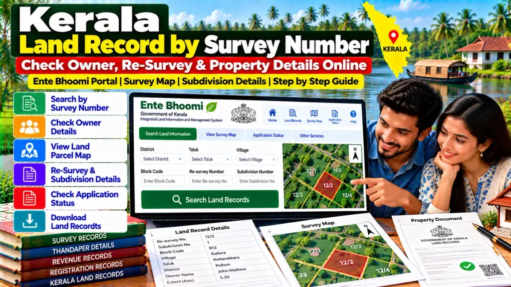
Kerala Survey Number Search – Overview
| Details | Information |
|---|---|
| Portal | Ente Bhoomi |
| Main Search Detail | Re-Survey Number |
| Other Detail | Subdivision Number |
| Location Details | District, Taluk, Village |
| Additional Detail | Block Code |
| Map Service | Digital Survey Map |
| Useful For | Property & Ownership Verification |
| Departments | Survey, Revenue & Registration |
What Is a Survey Number in Kerala?
A survey number identifies a specific parcel or group of land within a village survey system.
After re-survey, properties may also have a re-survey number and subdivision number. These details become important when comparing old property documents with Kerala’s newer digital survey records.
For accurate verification, always compare the survey information with:
- Registered sale deed
- Revenue records
- Land-tax details
- Thandaper information
- Mutation or transfer records
- Digital parcel map
- Physical property boundaries
How to Check Kerala Land Record by Survey Number
Kerala’s official digital-survey search currently asks users to enter or select:
District → Taluk → Village → Block Code → Re-Survey Number → Subdivision Number
After entering these details, users can search the available land information for villages covered by the digital re-survey system.
The service was specifically created so landowners in the applicable digital-survey villages can verify whether their land information has been correctly included in village records.
Re-Survey Number vs Old Survey Number
An older registered deed may contain an old survey number, while a newer digital record may use a different re-survey number.
This does not automatically mean that the documents relate to different properties.
Kerala Government rules provide for correlation between digitally surveyed parcels and old survey or re-survey numbers where corresponding data is available. New digital land-tax receipts may also show the corresponding old survey information for easier identification.
When purchasing older property, checking this correlation can be particularly important.
What Is a Subdivision Number?
A subdivision number identifies a smaller portion created within a larger survey parcel.
For example, one survey parcel may later be divided among family members or transferred in separate portions.
In such cases, buyers should compare:
Re-Survey Number + Subdivision Number + Land Extent + Registered Deed + Parcel Map
Checking only the main survey number may result in reviewing the wrong portion of land.
Can You View the Kerala Digital Survey Map?
Yes. Ente Bhoomi currently provides a Digital Survey Map facility where users can select the district, Taluk and village to view digital-survey land information.
A parcel map can be useful for checking:
- Location of the land
- Parcel shape
- Adjacent parcels
- Survey boundaries
- Subdivision layout
However, a digital map should not be treated as a substitute for an official boundary survey where there is a dispute.
Why Check Survey Number Before Buying Land?
Property purchases can involve significant financial risk.
Before paying a large advance, verify:
- Seller’s registered deed
- Re-survey number
- Subdivision number
- Block code
- Digital parcel map
- Land extent
- Revenue and Thandaper information
- Mutation or transfer details
- Encumbrance-related records
- Physical possession and boundaries
A mismatch in the survey number or subdivision should be investigated before registration.
Survey Number and Property Transfer
Kerala’s integrated land system is increasingly linking survey information with property-transfer procedures.
Under the rules applicable to digitally surveyed villages, a digitally prepared pre-mutation sketch containing Thandaper account details is mandatory for transfer of registry in covered land-transfer cases.
This makes correct survey and subdivision information particularly important before a sale, inheritance transfer or other registry change.
Survey Records and Property Loans
Accurate land records can also become important for:
- Home loans
- Land purchase loans
- Mortgage finance
- Loan against property
- Property valuation
- Legal due diligence
Banks may compare survey details with title deeds, revenue records and other property documents before approving finance.
Kerala’s Survey and Land Records Department also issues records such as Field Measurement Sketches, Block Maps, Land Registers, BTR records and correlation statements for applicable properties.
What If Your Land Record Is Missing?
For villages covered under the applicable digital-survey phase, Ente Bhoomi provides a facility for landowners to report land information when their property is not correctly appearing in the village records.
Before reporting an issue, verify the district, village, block code, re-survey number and subdivision number carefully.
Frequently Asked Questions
Can Kerala land records be searched by survey number?
Yes. The official Ente Bhoomi digital-survey search supports re-survey number and subdivision number searches.
What details are required?
District, Taluk, village, block code, re-survey number and subdivision number are currently used in the official search.
Can I view a parcel map?
Yes. Ente Bhoomi provides a digital survey-map service for applicable villages.
What if my deed has an old survey number?
Check the correlation between old and digitally surveyed parcel numbers where available.
Is survey number enough to verify ownership?
No. Also check the registered deed, revenue records, mutation information, encumbrances and physical possession.
Should I check subdivision number before buying land?
Yes. It helps identify the exact portion of a larger survey parcel.
Conclusion
Kerala Land Record by Survey Number provides a convenient way to identify and verify property through Ente Bhoomi. By checking the re-survey number, subdivision, block code, parcel map, registered deed and revenue records, landowners and buyers can perform stronger property verification before a purchase, loan, inheritance or transfer.