Karnataka Revenue Map / Village Map – Check Survey, Boundary & Land Details Online
Karnataka Revenue Map / Village Map can be useful for landowners, farmers and property buyers who want to understand the location, survey boundaries and layout of a rural land parcel. While RTC/Pahani provides textual land information, survey-related documents such as Tippan, Atlas, PT Sheet and Survey Sketch can help users understand the physical identification of the property.
Karnataka’s Bhoomi land-record system provides access to documents including RTC, Mutation Extract, Mutation Status and Tippan.
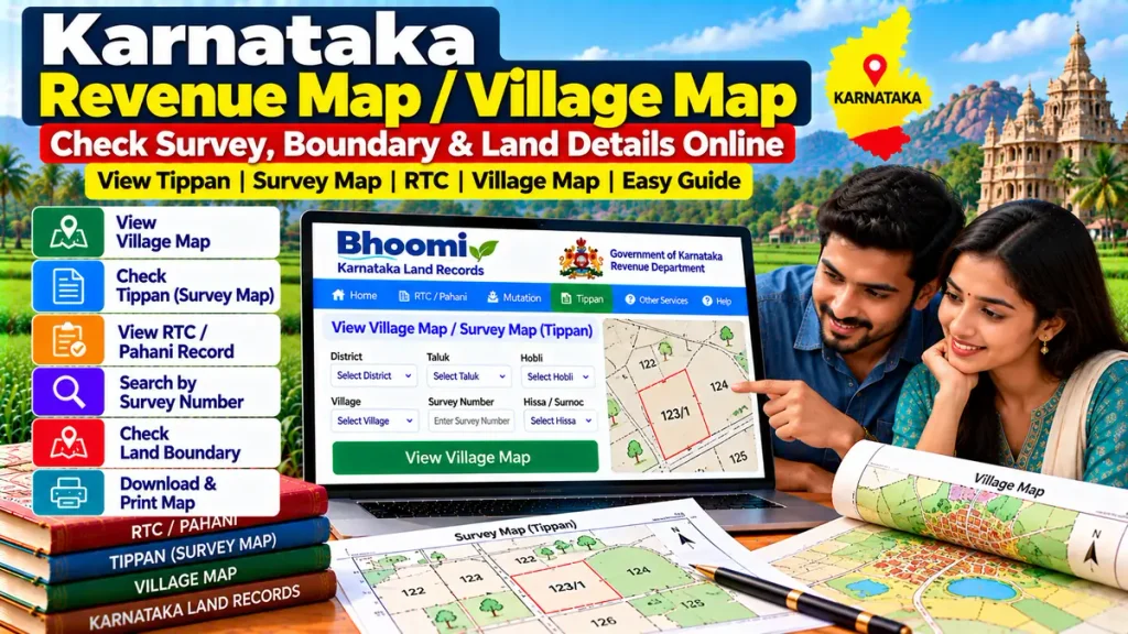
Karnataka Revenue Map – Overview
| Details | Information |
|---|---|
| Record Type | Revenue / Survey Map |
| Related Document | Tippan |
| Main Identifier | Survey Number |
| Related Record | RTC / Pahani |
| Other Documents | Atlas, PT Sheet, Survey Sketch |
| Useful For | Boundary & Property Verification |
| Department | Revenue / Survey, Settlement & Land Records |
| Property Type | Mainly Rural / Agricultural Land |
What Is a Karnataka Revenue Map?
A Revenue Map or Village Map shows the survey layout of land within a revenue village.
It can help users understand:
- Survey-number locations
- Adjoining land parcels
- Village boundaries
- Parcel shape
- Access roads
- Nearby natural features
- Survey subdivisions
For detailed property transactions, official survey documents can be more useful than relying only on a general village map.
What Is Tippan?
Tippan is one of the important survey-related land documents available through Karnataka’s Bhoomi services.
Karnataka Government district information lists Tippan together with RTC, Mutation Extract and Mutation Status as documents available to citizens.
A Tippan may help when checking survey measurements and the configuration of a land parcel.
For buyers, it is useful to compare Tippan information with the survey number and land extent shown in the RTC/Pahani.
Survey Sketch, Atlas and PT Sheet
For detailed land verification, other survey documents may also be important.
A Karnataka Government land-development regulation specifically lists a Survey Sketch/Atlas/PT Sheet, certified by the competent Revenue Department or Department of Survey Settlement and Land Records authority, among important property documents. The sketch is expected to show information including plot boundaries and relevant access features.
This makes these records particularly valuable when exact measurements or boundaries matter.
How to Check Karnataka Land Map Details
Start by identifying the property correctly through the Bhoomi land-record system.
Keep these details ready:
District: Select the district where the property is located.
Taluk: Choose the relevant Taluk.
Hobli: Select the correct Hobli.
Village: Choose the revenue village.
Survey Number: Enter or identify the land parcel.
Hissa Number: Check the subdivision where applicable.
Then review the available RTC/Pahani and survey-related documents such as Tippan.
The Karnataka Government directs citizens to the official Bhoomi portal at landrecords.karnataka.gov.in for land-record services.
Revenue Map vs RTC/Pahani
A Revenue Map and RTC serve different purposes.
RTC/Pahani: Shows textual information relating to rights, tenancy, crops, land extent and ownership-related records.
Revenue Map / Tippan: Helps understand the physical survey layout and parcel-related measurements.
For stronger property verification, both should be checked together.
Why Check Village Map Before Buying Land?
A property may appear correct on paper, but its physical location and boundaries should also correspond with the survey records.
Before purchasing land, compare:
- Survey number
- Hissa number
- Latest RTC/Pahani
- Tippan
- Survey Sketch / Atlas / PT Sheet
- Mutation Extract
- Registered sale deed
- Encumbrance Certificate
- Actual physical boundaries
This can help identify potential boundary, subdivision or access issues before completing a major transaction.
Survey Number and Hissa Details
A single survey number may sometimes be divided into multiple Hissa or subdivision numbers.
If you are purchasing only part of a larger survey number, make sure you verify:
- Correct Hissa
- Recorded land extent
- Survey boundaries
- Seller’s rights
- Mutation history
Checking only the main survey number may not be enough in a subdivided property.
Revenue Map and Property Loans
Survey documents can also become relevant during:
- Agricultural loans
- Land purchase finance
- Mortgage loans
- Loan against property
- Property valuation
- Layout or development approval
Karnataka Government documentation lists RTC, Mutation Register Extract, registered ownership documents, Encumbrance Certificate and certified Survey Sketch/Atlas/PT Sheet among important documents for certain property-development applications.
This shows why accurate survey documentation can be important for both legal and financial verification.
Boundary Disputes and Official Survey
A digital map or Tippan is useful for preliminary verification, but it may not resolve every boundary dispute.
If the actual possession or fencing does not match the available survey record, an official land survey or measurement may be required.
Do not rely only on an online image when a boundary dispute involves significant property value.
Frequently Asked Questions
Can Karnataka survey-related land records be accessed through Bhoomi?
Yes. Karnataka Government lists Tippan among Bhoomi land-record services.
What is Tippan?
Tippan is a survey-related land document used to understand parcel measurements and survey information.
Is a village map the same as RTC?
No. RTC contains textual land information, while maps and Tippan help with the physical survey layout.
What is a Hissa number?
A Hissa number identifies a subdivision within a larger survey number.
Should I check a survey map before buying land?
Yes. It can help verify parcel location, subdivision and boundaries when checked together with RTC, deed and mutation records.
Is a survey map enough to settle a boundary dispute?
Not always. A disputed boundary may require an official survey or measurement.
Conclusion
Karnataka Revenue Map / Village Map can help landowners and buyers understand the physical survey layout of rural property. By comparing Tippan, Survey Sketch, Atlas/PT Sheet, RTC/Pahani, survey number, Hissa, mutation records and registered documents, users can perform stronger property verification before buying, developing, financing or dividing land.