Kerala FMB Sketch Online – Check Survey Map, Measurements & Land Boundary Details
Kerala FMB Sketch Online is useful for landowners and property buyers who want to check the survey-side details of a property, including its survey number, subdivision, measurements and parcel boundaries. FMB commonly refers to a Field Measurement Book sketch, an important survey document used while identifying and measuring land parcels.
Kerala’s digital land administration is increasingly being handled through Ente Bhoomi, which integrates Survey, Revenue and Registration services and provides digital survey and parcel-related information for applicable villages.
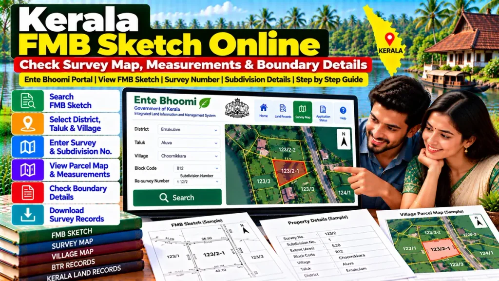
Kerala FMB Sketch – Overview
| Details | Information |
|---|---|
| Document | FMB / Field Measurement Sketch |
| Main Purpose | Survey and boundary information |
| Important Details | Survey No., Subdivision, Measurements |
| Related Portal | Ente Bhoomi |
| Related Records | BTR, Survey Map, Land Records |
| Useful For | Property Verification & Boundary Check |
| Department | Survey and Land Records, Kerala |
| Property Type | Land parcels covered by survey records |
What Is an FMB Sketch?
An FMB Sketch is a field-measurement record connected with the physical survey of a land parcel.
Kerala’s Digital Survey Standard Operating Procedure specifically lists FM sketches, blueprints and divided sketches among the records used during the digital survey process. It also lists village maps, block maps, BTR and other land records as supporting survey documents.
An FMB sketch can therefore be useful for understanding:
- Parcel measurements
- Survey boundaries
- Subdivisions
- Shape of the property
- Adjacent survey portions
- Historical survey references
How to Check Kerala Survey Details Online
For applicable digitally surveyed villages, Kerala’s Ente Bhoomi survey search currently uses:
District → Taluk → Village → Block Code → Re-Survey Number → Subdivision Number
After entering the correct details, users can check available digital survey information for the land parcel.
The re-survey number and subdivision are particularly important because they help identify the exact portion of land instead of only the broader survey parcel.
FMB Sketch vs Digital Parcel Map
An FMB sketch and a modern digital parcel map are related but not necessarily identical.
FMB Sketch: Traditionally focuses on field measurements and survey geometry.
Digital Land Parcel Map: Uses Kerala’s newer digital survey data to represent the mapped parcel.
Ente Bhoomi currently provides real-time land parcel maps for applicable properties, with the Revenue portal stating that GNSS-based digital survey maps can provide positional accuracy in the range of approximately 3–5 centimetres.
For current transactions, checking both historical survey records and newer digital parcel information can be useful.
Why Survey Number and Subdivision Matter
Suppose a larger survey number has been divided into several properties. Checking only the main survey number may not identify the exact land being sold.
Always compare:
Re-Survey Number: Main parcel reference.
Subdivision Number: Identifies the specific divided portion.
Land Extent: Should correspond with the deed and revenue records.
Parcel Map/FMB: Helps identify the physical land.
This becomes especially important in inherited property or partial land sales.
Why Check FMB Before Buying Land?
Before purchasing land, buyers should verify both ownership documents and physical survey information.
Compare:
- Registered sale deed
- Survey / re-survey number
- Subdivision number
- FMB or survey sketch
- Digital parcel map
- Thandaper details
- BTR or applicable revenue records
- Mutation information
- Encumbrance-related records
- Actual physical boundaries
This can help identify possible differences between the land shown on paper and the parcel being physically offered.
FMB Sketch and Boundary Disputes
An FMB or survey sketch can be particularly useful when neighbours disagree about a property boundary.
However, simply viewing an old sketch may not completely resolve a dispute.
If:
- Boundary stones are missing
- Fencing does not match records
- Land extent differs
- The property has been subdivided
- Old and new survey numbers do not correspond clearly
an official survey or measurement may be necessary.
Kerala’s digital re-survey programme is intended to prepare updated digital survey records for villages across the state.
FMB Sketch and BTR
BTR, or Basic Tax Register, is another important Kerala revenue record.
Kerala’s Digital Survey SOP lists the Settlement Register/BTR along with FM sketches and village maps among records used for digital survey work.
The FMB focuses more on measurement and boundaries, while BTR contains revenue-related land information.
Checking the two together can provide stronger verification.
FMB and Property Loans
Survey records may also become important for:
- Home loans
- Land purchase loans
- Mortgage finance
- Loan against property
- Building construction
- Property valuation
- Legal due diligence
Banks or legal professionals may ask for survey sketches, title deeds, tax records and revenue documents depending on the property.
Accurate survey records can therefore help during property-loan and mortgage documentation.
Digitally Surveyed Villages
It is important to note that Ente Bhoomi services depend on the stage of digital survey in a village.
The official portal states that after digital survey work is completed and records are transferred to the Revenue Department following the applicable Section 13 publication, services for those properties become available through the integrated Ente Bhoomi portal.
For villages where digital survey work is still underway, the survey-side portal continues to provide relevant services.
Frequently Asked Questions
What is Kerala FMB Sketch?
FMB is a field-measurement survey record used to identify parcel dimensions, subdivisions and boundaries.
Can Kerala survey records be checked online?
Yes. Ente Bhoomi provides digital survey searches for applicable villages using district, Taluk, village, block, re-survey and subdivision details.
Is FMB the same as a parcel map?
No. FMB is a survey-measurement record, while the newer digital parcel map uses Kerala’s digital survey data.
Does subdivision number matter?
Yes. It helps identify the exact portion within a larger survey parcel.
Is FMB useful before buying land?
Yes. It can help compare property measurements and boundaries with the deed and digital survey records.
Can FMB alone prove ownership?
No. Ownership verification should also include the registered deed, revenue records, mutation details and other applicable documents.
Conclusion
Kerala FMB Sketch Online can help landowners and buyers understand the physical survey details of a property. By comparing the FMB, re-survey number, subdivision, digital parcel map, Thandaper, BTR and registered deed, users can perform stronger verification before a property purchase, loan, inheritance or boundary-related transaction.