Assam BhuNaksha / Land Map Online – Check Dag, Patta & Cadastral Map Details
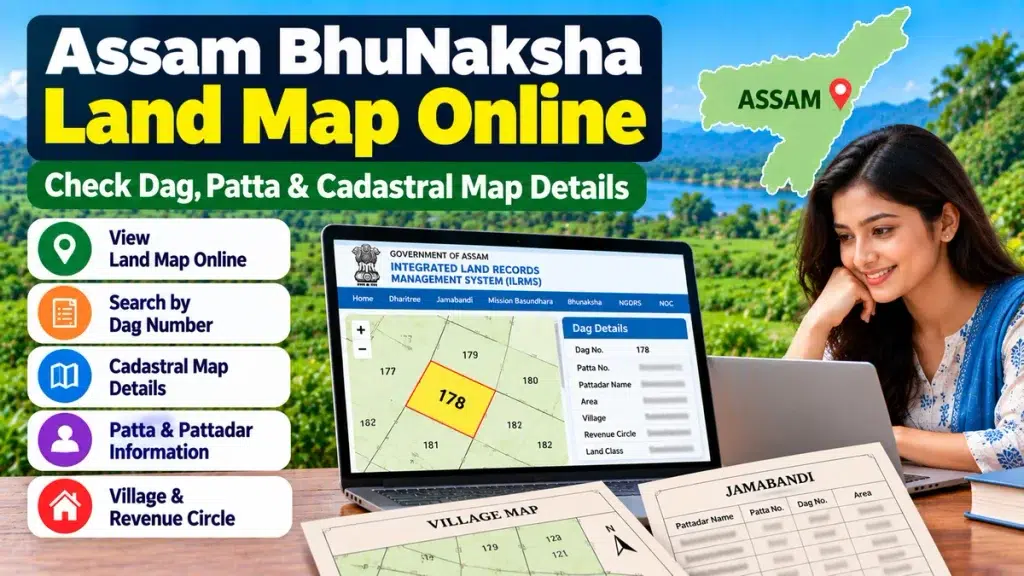
If you want to check the land map of a property in Assam, BhuNaksha can be an important tool. It helps users view cadastral mapping information connected with land parcels and can be useful while checking a Dag Number, property location, land boundaries or other revenue-record details.
The Government of Assam’s Integrated Land Records Management System (ILRMS) lists BhuNaksha as its cadastral mapping software, alongside Dharitree, Jamabandi, Mission Basundhara and property-registration services.
For people planning to buy land, verify inherited property, apply for mutation, arrange property finance or check documentation before registration, comparing the map with other land records can help reduce errors.
What Is Assam BhuNaksha?
BhuNaksha is a digital cadastral mapping system used to display map-based information about land parcels.
A cadastral map generally divides a revenue area into individual plots or Dags. Depending on the available digital record, users may be able to identify information associated with a particular parcel.
The Assam ILRMS system itself describes BhuNaksha as an online cadastral mapping software.
Assam Land Map – Important Details
| Detail | Why It Is Useful |
|---|---|
| Dag Number | Identifies a particular land parcel |
| Cadastral Map | Shows mapped plots in an area |
| Village | Helps locate the correct revenue record |
| Revenue Circle | Identifies administrative jurisdiction |
| Patta Details | Connects the parcel with landholding records |
| Jamabandi | Helps check Record of Rights information |
| Land Area | Useful for comparing recorded property size |
| Mutation | Helps confirm updated ownership records |
How to Check Assam BhuNaksha / Land Map Online
Step 1: Open Assam ILRMS
Visit the official Assam Integrated Land Records Management System and choose the BhuNaksha service where available.
Step 2: Select the Correct Location
Land-map searches may require location details such as:
- District
- Revenue Circle
- Mouza
- Village
- Dag Number
Selecting the correct village is important because land records and Dag Numbers are tied to particular revenue areas.
Step 3: Find the Relevant Dag
Locate the required Dag or plot on the available cadastral map.
Assam’s ILRMS systems also show map-related facilities where village records can contain individual Dags with fields such as Dag Number, land class and area, along with options to view maps or BhuNaksha maps where records are available.
Step 4: Compare the Map With Land Records
After finding the plot, compare it with:
- Jamabandi
- Patta Number
- Pattadar name
- Recorded land area
- Registered deed
- Mutation records
Never rely only on the visual map for a major property transaction.
Why Check the Land Map Before Buying Property?
Land purchase can involve a substantial financial commitment. A cadastral map can help a buyer understand which land parcel is associated with the documents being presented.
Before making payment, consider checking:
- Correct Dag Number
- Patta Number
- Pattadar name
- Jamabandi
- Recorded land area
- Property location
- Physical boundaries
- Mutation status
- Registered sale deed
- Revenue receipts
- Existing mortgage or dispute
For expensive land purchases, professional legal verification and, where necessary, an official land survey can provide additional protection.
BhuNaksha and Dag Number
A Dag Number is especially important when working with land maps because it identifies an individual parcel.
Mission Basundhara’s land-service processes also use district, circle, village and Dag information to identify a property, with the corresponding land schedule being populated for the selected Dag in several services.
This makes the Dag Number an important link between the mapped parcel and other revenue records.
BhuNaksha and Jamabandi
BhuNaksha and Jamabandi serve different purposes.
BhuNaksha primarily provides cadastral mapping information, while Jamabandi provides Record of Rights information relating to a landholding.
For better property verification, check both along with the Patta, Dag details and registered documents.
Why Land Maps Matter for Home Loans
Banks and housing-finance companies may conduct legal and technical verification before approving property-backed finance.
Depending on the property, they may review:
- Title deed
- Jamabandi
- Patta and Dag details
- Mutation records
- Land area
- Site or cadastral plan
- Revenue receipts
- Property approvals
- Encumbrance documents
Clear property identification can be important for a home loan, construction loan, mortgage or loan against property.
Is an Online Land Map a Final Proof of Boundary?
No. A digital cadastral map is useful for checking the recorded parcel, but it should not automatically be treated as a final on-ground boundary measurement.
If there is a boundary dispute or significant difference between the map and physical possession, contact the appropriate revenue authority and consider an official survey or demarcation.
Frequently Asked Questions
What is BhuNaksha Assam?
BhuNaksha is Assam ILRMS’s cadastral mapping software for land-map information.
Can I check an Assam land map online?
Assam ILRMS provides BhuNaksha as part of its digital land-record ecosystem. Availability of a particular map can depend on the relevant digitised record.
What is a Dag Number on a land map?
A Dag Number identifies a specific parcel or plot in the revenue records.
Is BhuNaksha the same as Jamabandi?
No. BhuNaksha relates to cadastral maps, while Jamabandi contains Record of Rights information.
Can a BhuNaksha map be used before buying land?
Yes, it can be useful for preliminary parcel verification, but buyers should also check title documents, Jamabandi, mutation and other legal records.
What if the online map is unavailable?
Some records may not be digitally available. In such cases, check with the concerned Circle Office or appropriate revenue authority.
Conclusion
Assam BhuNaksha / Land Map Online can help citizens identify land parcels and compare Dag, Patta, Jamabandi and mapped land information before important property decisions.
Whether you are purchasing land, verifying ancestral property, applying for mutation or preparing documents for property finance, checking the cadastral map together with other official records can make land verification more reliable.