Land Ownership Details Online – How to Check Landholder Records From Your Mobile
Checking land records no longer always requires visiting a revenue office. Across India, many States and Union Territories provide digital land-record services that allow citizens to view available landholder records, Record of Rights (RoR), plot details, survey numbers and land maps from a mobile phone.
The exact name of a land record varies from one state to another. Depending on the location, you may see terms such as RoR, Jamabandi, Khatauni, Khatian, RTC, Pahani, Patta, 7/12, Adangal or B-1. Parcel references can also be called Khasra Number, Survey Number, Plot Number, Gata Number or Dag Number.
Despite these differences, the basic purpose is similar: helping citizens understand the land information recorded by the relevant Revenue Department.
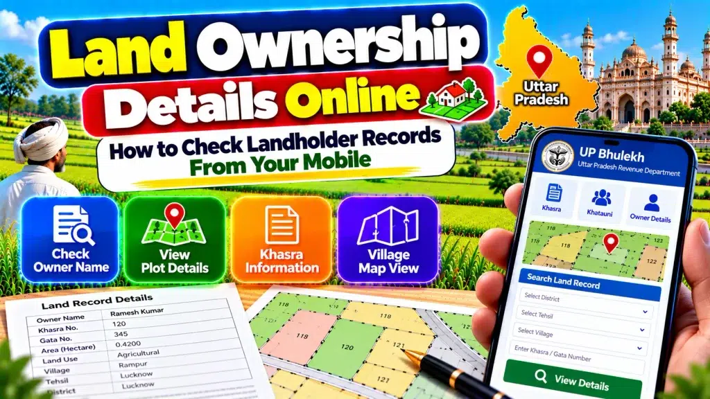
This guide explains Land Ownership Details Online, how to check landholder records from your mobile, what information you may find and what should be verified before relying on an online record for an important property transaction.
Land Ownership Details Online – Quick Overview
| Details | Information |
|---|---|
| Service | Online Land Record Search |
| Device | Smartphone, Tablet or Computer |
| Main Record | Record of Rights / State Land Record |
| Landholder Name | Available in applicable records |
| Parcel Reference | Khasra / Survey / Plot / Gata / Dag Number |
| Holding Reference | Khata / Khatian or state-specific equivalent |
| Land Area | Available in applicable records |
| Land Classification | May be available |
| Cadastral Map | Available in many digitized areas |
| Mutation Information | Available in many states |
| Certified Copy | Depends on state service |
| Main Authority | State/UT Revenue Department |
| National Programme | DILRMP |
| ULPIN / Bhu-Aadhaar | Implemented in many States/UTs |
| Mobile Access | Through applicable official state portals |
What Are Land Ownership Records?
Land records are official revenue and survey records maintained by State and Union Territory authorities.
One of the most important records is the Record of Rights or RoR.
An RoR can contain information about persons who have recorded rights in land, the nature and extent of those rights, and applicable revenue or rent information.
Different states use different names and formats for these records.
For example, users may encounter Jamabandi in some northern states, RTC/Pahani in Karnataka, Patta-related records in Tamil Nadu, Khatian in West Bengal and other state-specific documents elsewhere.
Can You Check Landholder Details From a Mobile?
In many states, yes.
If the relevant land record has been digitized and made available through an official citizen portal, it can generally be accessed through a smartphone web browser.
You do not necessarily need a desktop computer simply to view an online land record.
The exact information required to search depends on the state.
Common search details include District, Tehsil or Taluk, Village, Khata/Khatian Number, Survey/Khasra/Plot Number or recorded landholder name.
How to Check Land Ownership Details Online
Start by identifying the state where the land is located.
Open the official land-record portal of that State or Union Territory.
On your mobile, choose the available RoR, land-record, Jamabandi, Khatauni, RTC, Patta or equivalent service.
Select the correct District.
Choose the relevant Tehsil, Taluk, Mandal, Block or other local revenue unit.
Select the Village or Mouza.
Use one of the available search references, such as landholder name, Khata Number, Khasra Number, Survey Number or Plot Number.
Open the matching record and carefully review all available information.
How to Check Landholder Name
After finding the correct land record, look for the recorded landholder, raiyat, pattadar, khatedar or equivalent field used by that state’s system.
Do not rely only on a matching name.
Two people can have the same or similar names.
Where available, compare additional information such as parent, spouse or guardian name, Khata/Khatian reference, Survey Number, Plot Number and Village.
These details help determine whether you have located the correct land record.
How to Search Using Khasra or Survey Number
A Khasra, Survey, Gata, Plot or Dag Number generally serves as a parcel-level reference within the applicable state land-record system.
If you already know the parcel number, it can be one of the easiest ways to locate land information.
Enter or select the correct parcel reference after choosing the required location.
Then compare the resulting landholder, area and holding information with your property documents.
Never search using only the number without confirming the Village or revenue location.
How to Search Using Khata or Khatian Number
A Khata or Khatian generally relates to a broader landholding or Record of Rights reference, depending on the state.
A holding may contain more than one individual parcel.
Therefore, after finding a Khata/Khatian, review all the Survey, Khasra, Plot or Gata Numbers associated with it.
If you are checking one particular property, identify exactly which parcel is relevant rather than assuming that every plot under the holding is part of the same transaction.
How to Check Land Area
Online revenue records often provide the recorded area or extent of the relevant parcel.
The unit of measurement varies between states and records.
Check the area against the correct Survey, Khasra or Plot Number.
If a property consists of multiple parcels, check each parcel individually before calculating the total.
Compare the online information with your registered deed and other relevant documents.
A significant mismatch in area should be investigated through the appropriate Revenue or Survey authority.
How to View Land Maps From Mobile
India’s land-record modernization programme includes digitization of cadastral maps and integration of textual Records of Rights with spatial land records.
Many state systems therefore provide applicable online land-map services.
After finding your Survey, Khasra or Plot Number, you may be able to locate the parcel on a cadastral map.
This can help you understand the parcel’s shape and relative position.
However, an online map should not automatically be treated as an official physical demarcation when the exact boundary is disputed.
What Is Mutation in Land Records?
Mutation is the revenue-record process associated with updating applicable land records after a qualifying change in rights.
It can become relevant after events such as sale, inheritance, gift or partition, depending on state rules.
Many state land-record systems provide online mutation applications, status checks or mutation-entry information.
If a recent buyer or successor does not appear in the available land record, check the applicable mutation information.
Remember that a registered deed and a mutation entry serve different functions.
What If an Old Owner’s Name Is Showing?
First make sure you are checking the correct Village and parcel.
Compare the current online record with the registered deed, inheritance documents and mutation information.
An old landholder may continue to appear where the relevant revenue-record update has not yet been completed or reflected.
Do not assume that the online name alone settles the legal ownership question.
If the record needs updating, follow the applicable mutation or correction procedure provided by the concerned State Revenue Department.
What Is ULPIN or Bhu-Aadhaar?
ULPIN, also known as Bhu-Aadhaar, is the Unique Land Parcel Identification Number initiative under India’s land-record modernization programme.
ULPIN is designed as a unique 14-digit identifier for an individual land parcel based on geo-referenced parcel information.
Its implementation has expanded across many States and Union Territories.
However, users should not assume that every parcel everywhere will necessarily display ULPIN in the same way.
Availability and integration can depend on the state’s implementation and the relevant land record.
Are Online Land Records Free?
Basic online viewing is available through many government land-record portals, but services vary by state.
Some states may allow users to view land information without payment while charging an applicable fee for a digitally signed, certified or officially issued copy.
Always distinguish between simply viewing an online record and obtaining an authenticated or certified document.
Follow the fee and document instructions displayed on the relevant official portal.
Online Copy vs Certified Land Record
An online screen view is useful for checking basic information, but it should not automatically be considered the same as a certified copy.
Where a state provides digitally signed or certified RoR services, use that facility when an authenticated record is required.
Do not assume that a screenshot saved on your mobile has the same official status as a certified document issued through the prescribed process.
What If You Cannot Find Your Land Record?
First check the spelling of the Village and landholder name.
Confirm the District, Tehsil/Taluk and parcel reference.
Try the other search methods offered by the state portal.
If the record is old, recently mutated or not fully available through the online service, additional verification may be required.
The Department of Land Resources also notes that citizens can obtain applicable RoR information through local revenue officials or Common Service Centres where relevant.
How to Verify Land Before Buying Property
Start with the seller’s registered property document and identify the exact parcel.
Check the current online Record of Rights.
Compare the recorded landholder.
Verify the Survey/Khasra/Plot Number and land area.
Check the cadastral map where available.
Review applicable mutation information and relevant registration records.
If the property involves inheritance, partition, court proceedings or another legal event, examine the supporting documents as well.
For a significant transaction, professional legal verification may also be appropriate.
Does an Online Land Record Prove Ownership?
An online RoR or landholder entry is an important part of property verification, but users should avoid treating a single online entry as conclusive proof of legal title in every situation.
Property rights can involve registered sale deeds, inheritance or succession documents, gift or partition documents, mutation history, court orders, survey records and other legally relevant documents.
The exact legal effect of a revenue record can also depend on the applicable state law and circumstances.
Therefore, use online land records as part of a broader verification process.
Safety Tips When Checking Land Records on Mobile
Use the official State or Union Territory land-record portal.
Avoid unknown websites that ask for unnecessary personal or financial information.
Do not share your banking PIN, OTP or password simply to view a public land record.
Verify the website before paying for a certified record or other government service.
Save important application or transaction references if you submit an official request online.
Frequently Asked Questions (FAQ)
1. Can I check land ownership details from my mobile?
Yes. Many State and UT land-record portals allow applicable land records to be viewed through a mobile browser.
2. What is a Record of Rights?
RoR is an important revenue record containing information about persons with recorded rights in land and the nature or extent of those rights.
3. Can I search land by owner name?
Many state portals provide landholder-name search, but available search methods vary by state.
4. Can I search using a Survey or Khasra Number?
Yes, where the relevant state portal supports parcel-number search.
5. Can I check land area online?
Applicable digital land records can contain the recorded area or extent of a parcel.
6. Can I view a land map on my phone?
Many states provide digitized cadastral-map services for applicable areas.
7. What is mutation?
Mutation is the applicable revenue-record update process following a qualifying change in land rights.
8. Is a screenshot an official certified land record?
Not necessarily. A certified or digitally signed copy may need to be obtained through the state’s prescribed service.
9. What is Bhu-Aadhaar or ULPIN?
ULPIN is a 14-digit unique land-parcel identification number based on geo-referenced parcel information.
10. Does an online landholder name alone prove ownership?
No. Important property verification can also require registered deeds, mutation history and other relevant legal and revenue records.
Conclusion
Land Ownership Details Online services make it easier to check landholder records from your mobile without beginning every search with a physical visit to a revenue office.
Depending on the state, users can access records such as RoR, Jamabandi, Khatauni, Khatian, RTC, Pahani, Patta, Khasra or other state-specific land records.
The most important step is to use the official portal for the state where the property is located and verify the correct District, local revenue unit, Village and parcel reference.
For important property matters, compare the online landholder information with Survey/Khasra/Plot details, land area, cadastral maps, mutation information, registered documents and other relevant records. A mobile land-record search is an excellent starting point, but complete property verification should consider all applicable legal and revenue documents.